When you start poking around the older industrial parks near Highway 7 or the residential pockets backing onto the Oak Ridges Moraine, you quickly realize Vaughan's subsurface isn't uniform. We've seen clay till draped over sandy lenses, buried valleys, and even pockets of organics that don't show up on a standard borehole log alone. That's where electrical resistivity fills the gap. It's not about replacing drilling; it's about reading between the boreholes. A vertical electrical sounding (VES) program can sketch the depth to bedrock under a future stormwater pond or flag a saturated zone before you mobilize an excavator—without disturbing the ground. For larger corridor studies, combining resistivity profiles with a CPT test often gives us both the stratigraphic picture and the continuous mechanical data in one campaign, which saves time when the schedule is tight.
Resistivity doesn't just find water—it helps explain why two boreholes 30 metres apart can hit completely different materials.
Service characteristics in Vaughan
Local geotechnical conditions in Vaughan
The Ontario Building Code (OBC) and CSA A23.3 set the structural requirements, but the geotechnical investigation has to identify the ground conditions that trigger those requirements. One scenario we see repeatedly in Vaughan is a planned basement excavation that hits a confined sand layer feeding water into the cut. If a VES survey had been run early, the resistivity contrast between that sand and the surrounding till would have been visible before shovels moved. The risk isn't just extra dewatering cost; it's the potential for fines and foundation settlement in the neighbouring properties—something the City of Vaughan takes seriously under its site alteration by-law. The Ontario Ministry of the Environment also expects Phase Two ESAs to consider geophysical evidence where contamination plumes might follow preferential pathways. A well-documented resistivity survey, calibrated to a few boreholes, satisfies that expectation and makes the remedial action plan defensible. Ignoring the layered hydrogeology of the moraine system is what turns a straightforward dig into a regulatory headache.
Our services
Our resistivity work in Vaughan covers everything from quick VES soundings for a single-family addition to multi-line 2D surveys for industrial subdivisions. We own our equipment, so we're not paying a middleman rental fee, and we handle the inversion and reporting in-house.
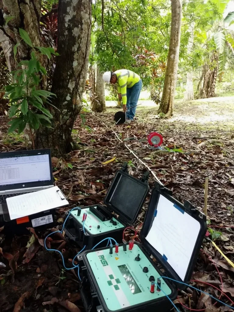
2D Electrical Resistivity Imaging
Multi-electrode profiles for cross-sectional imaging of overburden, bedrock surface, and groundwater conditions under proposed building pads or pond footprints.
Vertical Electrical Sounding (VES)
Deep one-dimensional soundings ideal for mapping depth to bedrock, aquifer thickness, or clay layer continuity beneath large lots.
Geophysical Integration with Drilling
Combining resistivity lines with SPT drilling to calibrate geophysical data and extend site characterization between boreholes.
Environmental Resistivity Surveys
Mapping leachate plumes, landfill boundaries, or salt-impacted groundwater in compliance with Ontario Phase Two ESA expectations.
Frequently asked questions
How much does an electrical resistivity survey cost in Vaughan?
For most sites in Vaughan, a resistivity survey runs between CA$780 and CA$1,300, depending on the number of soundings, line length, and whether we're running a simple VES or a full 2D profile. The final number is influenced by access constraints, traffic control on busier roads like Weston or Rutherford, and how much data processing is needed afterward. Tell us the size of the area and what you're trying to find—we'll give you a fixed price, not an estimate that climbs later.
What's the difference between VES and 2D resistivity imaging?
VES gives you a one-dimensional profile—think of it as a vertical snapshot at a single point, telling you how resistivity changes with depth. It's fast and works well when you expect flat-lying layers. A 2D resistivity line uses many electrodes along a transect to build a cross-section, showing lateral changes too. For mapping a buried channel under a future Vaughan warehouse, 2D is usually the better call.
Can resistivity surveys work in winter on frozen ground?
Yes, but with caveats. Frozen ground has very high resistivity, which can mask the contrasts we're looking for. We typically use a Wenner array and sometimes pre-wet the electrode stakes with salt solution to improve contact. Data collection is possible down to about -15°C with proper equipment, though interpretation gets trickier. If you can schedule the survey between April and November, that's ideal.
Do I still need boreholes if I run a resistivity survey?
Almost always yes. Resistivity tells you where the boundaries are and what the electrical properties look like, but it doesn't directly measure soil strength or give you samples for lab testing. The best approach—and the one that holds up with Vaughan's building department—is a resistivity survey calibrated with a few targeted boreholes. You get the continuous subsurface picture plus the physical samples to back it up.